

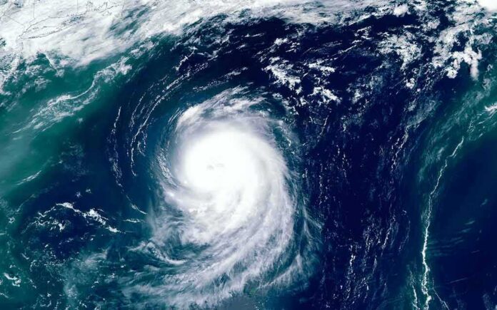
Hurricane Lowell has strengthened into a Category 4 storm with 150 mph winds and is on track to pass close to Hawaii’s western islands late Monday, forecasters say.
Story Snapshot
- The National Hurricane Center says Lowell could still be near major-hurricane strength when it nears the western Hawaiian Islands late Monday and Monday night.
- Kauai County faces the biggest risk of storm surge and damaging winds, according to official forecasts.
- Rain totals could top 10 inches on Kauai and the Big Island, with up to 8 inches possible on Maui.
- Watches could be issued for the westernmost islands as soon as Saturday, though none were active yet as of the latest advisories.
Storm Nears Category 5 Strength Before Turn
Hurricane Lowell carried maximum sustained winds near 150 mph on September 4, making it a strong Category 4 storm, according to National Hurricane Center advisories. The storm has moved west at about 9 mph but is expected to curve northwest and then north through the weekend, a shift that would carry it closer to Hawaii’s western islands.
Forecasters say Lowell will likely still pack near-major-hurricane strength when it moves close to the western Hawaiian Islands late Monday and into Monday night. That timing puts the storm’s most dangerous winds and waves within striking distance of the islands just as the work week begins, giving residents a narrow window to finish storm preparations.
Kauai Faces Sharpest Risk From Surge and Wind
The hurricane center singled out Kauai County as the area facing the greatest danger from storm surge and damaging wind, though it stressed that exact impacts remain uncertain. Rainfall forecasts point to 3 to 6 inches across Kauai and the Big Island, with isolated totals potentially exceeding 10 inches. Maui could see 2 to 4 inches, with isolated maximums near 8 inches.
National Weather Service marine forecasts for waters around Honolulu already showed rougher conditions building, with east-northeast winds of 20 to 25 knots and seas running 6 to 9 feet even before Lowell’s closest approach. Those readings reflect the outer edge of a storm system still hundreds of miles away, underscoring how far Lowell’s influence already extends across Pacific waters surrounding the islands.
Officials Urge Residents to Track the Forecast Closely
The National Hurricane Center told people in Hawaii to keep watching Lowell’s progress, warning that watches could be required for the westernmost islands as early as Saturday. As of the latest advisories, no coastal watches or warnings had been issued, meaning the threat remains based on forecast models rather than confirmed conditions on the ground.
Earlier forecast tracks charted Lowell moving steadily westward before angling toward higher latitudes, a pattern consistent with the storm’s current forecasted turn toward Hawaii. That long-range consistency has given forecasters more confidence in the general path, even as they caution that the exact timing and strength of any impact on the islands could still shift in the coming days.
Hawaii braces for major Hurricane Lowell, its 3rd storm threat in a month https://t.co/z9MmRWI1Lr
— KESQ News Channel 3 (@KESQ) September 5, 2026
Hawaii has faced a string of tropical threats this season, with Lowell marking the latest system to test the islands after earlier storms brought their own warnings earlier in the summer. The National Hurricane Center’s cautious wording, using phrases like “risk of” and “could be required,” reflects standard practice for storms whose final track is not yet locked in, even as intensity and rainfall estimates carry real weight for island residents making preparation decisions now.
Sources:
nypost.com, nhc.noaa.gov, forecast.weather.gov, ndbc.noaa.gov
© truetrendnews.com 2026. All rights reserved.